


Flash floods and rain hit the Valley last week. Phoenix Sky Harbor Airport recorded about 0.3 inches of rain in the official count. Meanwhile, places like Cave Creek, Mesa and Scottsdale got more than 3 inches of rain.
Randy Cerveny, a professor of geographical sciences at Arizona State University, says the rainfall is one of the first signs of what’s likely to come this fall and winter, as the much anticipated super El Niño is brewing in the Pacific Ocean this year. And it could have an upside for water-challenged Arizona.
Full conversation
LAUREN GILGER: Good morning, Randy.
RANDY CERVENY: Good morning.
LAUREN GILGER: Thanks for coming in, as always. So we got rain last week and I immediately wrote you a note and said, all of this rain, right, flash flooding, cooler weather, this is a big deal here. Is this the super El Niño, this kind of very headlined phenomenon that’s coming our way? Is this the first signs of it?
RANDY CERVENY: Well, it’s got some of the aspects of that. It’s also typical monsoonal flow because the two things are going to actually be interrelated. What we have is actually the idea that moisture comes up from the Pacific Ocean and from the Gulf of California and gets channeled into Arizona or New Mexico, as is going to happen this week.
LAUREN GILGER: OK. OK. So let’s talk about what this could look like in the Valley, right? Like we have this big super El Niño system. We’re seeing headlines all over the world, in fact, about its impacts. First of all, just tell us like, what is this?
RANDY CERVENY: Well, El Niño is a periodic warming of the central Pacific Ocean. Normally, what happens is you’ve got this really cold current called the Humboldt Current that comes up from Antarctica and runs along the coast of South America and then arcs into the Pacific Ocean, making the Pacific Ocean cold. But about every — well, until recently, about every five or seven years, we would have this readjustment where a big surge of warm water would come back from Australia and cover the Pacific Ocean. Now it’s happening more frequently.
LAUREN GILGER: Right. Right. Surprise, surprise. OK, so in the Southwest, as we’re seeing implications happen, as I said, all over the world for this super El Niño, what could this look like this fall and winter?
RANDY CERVENY: Well, just the latest news tells us that we have exceeded the temperatures of the ocean that were seen back in ’97, which is one really super strong El Niño that hit the Southwest. And it’s even become stronger than the one back in 1982, which is kind of what we gauge all El Niños against. So it’s online to become unprecedented, basically.
LAUREN GILGER: Wow. So unprecedented in terms of rainfall. We’re looking at potential flash flooding, I’m guessing, then here across the state?
RANDY CERVENY: Well, not always, but yes, in this particular case, we think it’s a pretty good shot that the fall and the winter are going to have above-normal precipitation throughout the Southwest. And that is, as we were talking about earlier, that could be both good and bad.
LAUREN GILGER: Right. OK, so let's talk about the good part of that, right? Because there does seem to be an upside here potentially for the Southwest as we talk about Colorado River cuts and our drying up reservoirs in Lakes Powell and Mead up north. All of this incredible challenge in terms of drought in the state, rain seems like a good thing. Like getting a lot of rain this fall and winter should be good for us in some ways, right?
RANDY CERVENY: Exactly. We’ve been in what’s called now a megadrought, a drought that’s not lasted just one or two years, but it’s basically been lasting over the Southwest for the last 30 years. And while one year — even an exceptionally wet year — isn’t going to totally recover that, it’s definitely going to help. And we need all the water that we can possibly get going into those reservoirs. That’s where the fall and the winter rains help so much.

LAUREN GILGER: Why is it fall and winter rains that help more than, you know, the monsoon rains, for example, that we see in the summer?
RANDY CERVENY: Well, the monsoon rains tend to cause flash flooding. They run off really fast and they don’t get a chance to be stored. So when we have the fall and the winter, it tends to be more gentle rain or it tends to be snow, and that allows it to be percolated down into the soil and slowly run off into the reservoirs where the reservoirs can hold on to it.
LAUREN GILGER: Right. A lot of this, though, always if we’re talking about reservoir levels and levels in the Colorado River, right, like has to do with snow in the Rocky Mountains up north, even further north, right?
RANDY CERVENY: For some of the reservoirs, yes. I mean, definitely for the Colorado River, for Lake Mead, Lake Powell — that’s where the water’s coming from. For us in the East Valley, SRP is in charge of the reservoirs that are along the Salt River, and so those supply most of the water to the east part of the Valley.
LAUREN GILGER: OK, so there are other ones down here that could be impacted by a lot of that fall and winter rain as well. OK, so let’s talk about the other side of that. That’s the upside, which is a big one potentially, a big upside for us as we’re facing all of this drought. But the downside, right, is potential flash flooding where, you know, we’ve seen we’re seeing concerns about that in New Mexico right now. California’s worried about their beaches washing away as this super El Niño comes in. Like, what are the downsides in Arizona, potentially?
RANDY CERVENY: Well, we’ve already seen some of that. Last week, if you remember, the Grand Canyon had that horrible, horrible flash flood that occurred in part due to the massive amount of moisture, but also in part due to the big fire that we had there last year that vegetation holds water in. When you get rid of the vegetation, you have a big storm, it flashes. And so we will probably see more of those kind of events, particularly in the fall, as as we move forward.
LAUREN GILGER: Especially anywhere there’s been a forest fire, wildfire, things like that, where you’re going to see that kind of runoff, it can be very dangerous, right?
RANDY CERVENY: Right. And keep in mind that over the Southwest over the last few years, we’ve had lots of big fires, so there are lots of fire scars that could be potentially problematic for flash floods.
LAUREN GILGER: Right. We’re seeing water rush down Oak Creek Canyon right now that is black from ash and soot, right?
RANDY CERVENY: Oh, yes.
LAUREN GILGER: What are you watching for, Randy, in the last minute or so here as we go forward into this, what could be as you say, unprecedented El Niño? What’s on your radar, not no pun intended?
RANDY CERVENY: Well, actually, that is one thing that we look at. But right now, we tend to look a lot at the satellite photos, and we want to see how many hurricanes are being born off the west coast of Mexico. You know right now, one of the the plus sides for the East Coast, during El Niño, we have less hurricanes in the Atlantic. And actually, so far this year, we’ve just passed the normal height of the Atlantic hurricane season, we haven’t had a named hurricane yet in the Atlantic Ocean.
LAUREN GILGER: That is an interesting point. All right, global implications as we said. Randy Cerveny, professor of geographical sciences at ASU, joining us. Randy, thank you so much. As always, appreciate it.
RANDY CERVENY: My pleasure.
-
On Sept. 8, KJZZ water reporter Alex Hager presented your questions and concerns to a panel of experts.
-
 Officials say the new plan is like digging in the "couch cushions" for promises to save Colorado River water, but compensation from the Arizona Water Banking Authority could help reach a larger goal.
-
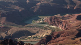 Arizona is still working on a deal with California and Nevada to spread out the pain of cutbacks, but they are still figuring out which cities and farms will use less water.
-
 Plans for a massive film studio and retail complex in Tonopah also include a large-scale data centerThe developer, Anita Verma-Lallian, says it could be the largest film studio in the country.
-
 California Gov. Gavin Newsom has declared a state of emergency ahead of what is expected to be a Super El Niño. That extra water presents challenges and opportunities to an area in the midst of ongoing drought.


